Sumatra Earthquake Tectonics
The maps and charts on these pages are derived from the USGS Poster of the Indonesian 'Quake of July, 2004, modified with data from the Great Indonesian Quake of December 26, 2004. The maps and charts on these pages are not official publications of the USGS.


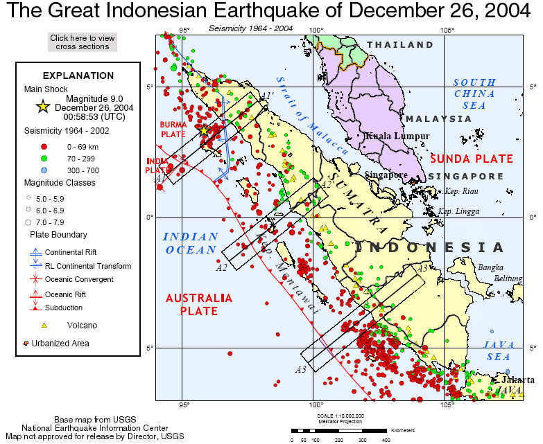
Note the increasing depth of 'quakes NE of the Australian/Sunda Plate boundary. Note also the small rift zone forming the SE boundary of the Burma Plate, and the intense seismicity of the area in the immediate vicinity of the main shock of the December 26, 2004 quake.
Go to the Tectonic Profiles
Go to the Indonesia Quake page
Get a Lab Exercise appropriate for grades 9-13.


Get this map as a printer friendly grayscale gif
Go to the Tectonic Profiles
Go to the Indonesia Quake page

Comments to Steve Kluge at Fox Lane High School Geoscience

FastCounter by bCentral